

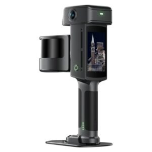
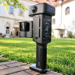
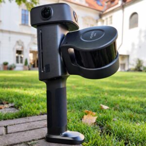
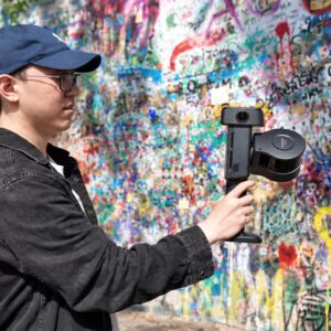
The Lixel L3 is the flagship handheld spatial scanner from XGRIDS, introduced in September 2026 at INTERGEO. It brings a high-accuracy LiDAR, a triple-camera 4K HDR vision system, an integrated survey-grade RTK receiver and a built-in 4.3-inch display together in a single handheld unit, so geometry, colour, positioning and on-site review all happen in one capture workflow. XGRIDS states a validated post-processed relative accuracy of 5 mm, demonstrated against measured ground truth in a documented test.
From a single walk-through, the same dataset produces three complementary deliverables: a true-colour point cloud for measurement, CAD drafting and Scan-to-BIM; a textured mesh that shows material surfaces and structural form; and a photorealistic 3D Gaussian Splatting (LCC) scene for digital twins, heritage documentation, client presentations and film production.
Key specifications
- LiDAR: Class 1, 905 nm, up to 120 m range; 16-channel (320,000 points/s) or 32-channel (640,000 points/s) configurations
- Post-processed relative accuracy: 5 mm (1 sigma, validated by XGRIDS in a dedicated 500 m² test environment)
- Absolute accuracy: 2 cm post-processed; 2.5 cm real-time
- Post-processed point-cloud thickness: 5 mm; repeatability: 2 cm
- Levelness: 0.005° with RTK fusion, 0.02° without RTK fusion
- Cameras: 3 x 50 MP, 1/1.3-inch sensor, 4096 x 3072 images, 4K HDR; forward RGB camera with a 100° x 85° field of view
- Positioning: integrated multi-constellation RTK (BDS, GPS, GLONASS, Galileo, QZSS, IRNSS, SBAS)
- Display: built-in 4.3-inch, 1,000-nit screen (480 x 480)
- Storage: 1 TB UFS
- Weight: 2.5 kg including battery; dimensions 206 x 107 x 329 mm
- Operating time: 100 minutes; protection rating IP54; operating temperature -20°C to 50°C
Accuracy you can use for engineering decisions
The L3 pairs 5 mm relative accuracy with 5 mm point-cloud thickness and improved levelness, which helps teams capture clean structural edges and reduces ambiguity when extracting geometry or modelling. Real-time loop-closure optimisation, a high-accuracy IMU and integrated RTK work together to constrain the scan trajectory over larger areas. This is particularly valuable in urban canyons, long or repetitive structures, tunnels and other low-feature environments, and on sites with obstructed GNSS, weak texture or reflective surfaces.
Imaging-grade true colour
Three 50 MP cameras on a 1/1.3-inch sensor, combined with 4K HDR, preserve detail across both bright and dark areas, making pipework, materials, signage and fine site features easier to identify. Local point-cloud enhancement can upsample selected objects such as pipes, railings and nameplates without processing the entire scene. The improved imaging carries through to every visual output: the true-colour point cloud, the textured mesh and the 3DGS scene.
Usable data before you leave site
- A true-colour point cloud is generated in real time, with the point cloud, trajectory and coverage shown on the built-in screen, so gaps can be found on site without relying on a connected phone
- On-device processing includes real-time noise filtering and smoothing, dynamic removal of moving people, loop-closure optimisation and levelness optimisation
- Real-time WGS 84 and CGCS2000 coordinate conversion
Built for field operation
The supplied support rig combines a shoulder strap, torso brace and telescoping arm, so the rig carries the weight of the scanner while the operator guides and steadies it during longer sessions. A control-point tip at the base of the handle lets you capture wall control points without tilting the unit, triggered from the screen or the power button. The L3 is also compatible with standard RTK survey poles, so no proprietary extension pole is required, and clip-on batteries with fast charging support continuous fieldwork.
Outputs and software
- True-colour point cloud for measurement, plans, elevations, sections, CAD and Scan-to-BIM
- Textured mesh for material surfaces and structural form
- Lixel CyberColor (LCC) 3D Gaussian Splatting scene for immersive, photorealistic visualisation
- Creator Data gives technical teams access to perspective images, COLMAP datasets, original imagery and 3DGS intermediate data
- Processed with LixelStudio (point cloud) and Lixel CyberColor Studio (3DGS); LCC outputs can move into platforms such as Unreal Engine and NVIDIA Isaac Sim, and SDKs and plugins support specialised pipelines
16-channel or 32-channel?
Both versions offer a scan range of up to 120 m. Choose the 16-channel model for routine surveying and reality-capture projects where the extra data density is not required. Choose the 32-channel model when higher scan rate, denser coverage and fine detail matter, for example on complex structures and detail-intensive engineering environments, where denser data can also reduce the number of passes needed.
Typical applications
Surveying, construction, BIM and Scan-to-BIM, infrastructure, asset management, mining, forestry, tunnels, digital twins, heritage documentation and film production.
Contact us for pricing, availability and to book a live demo.