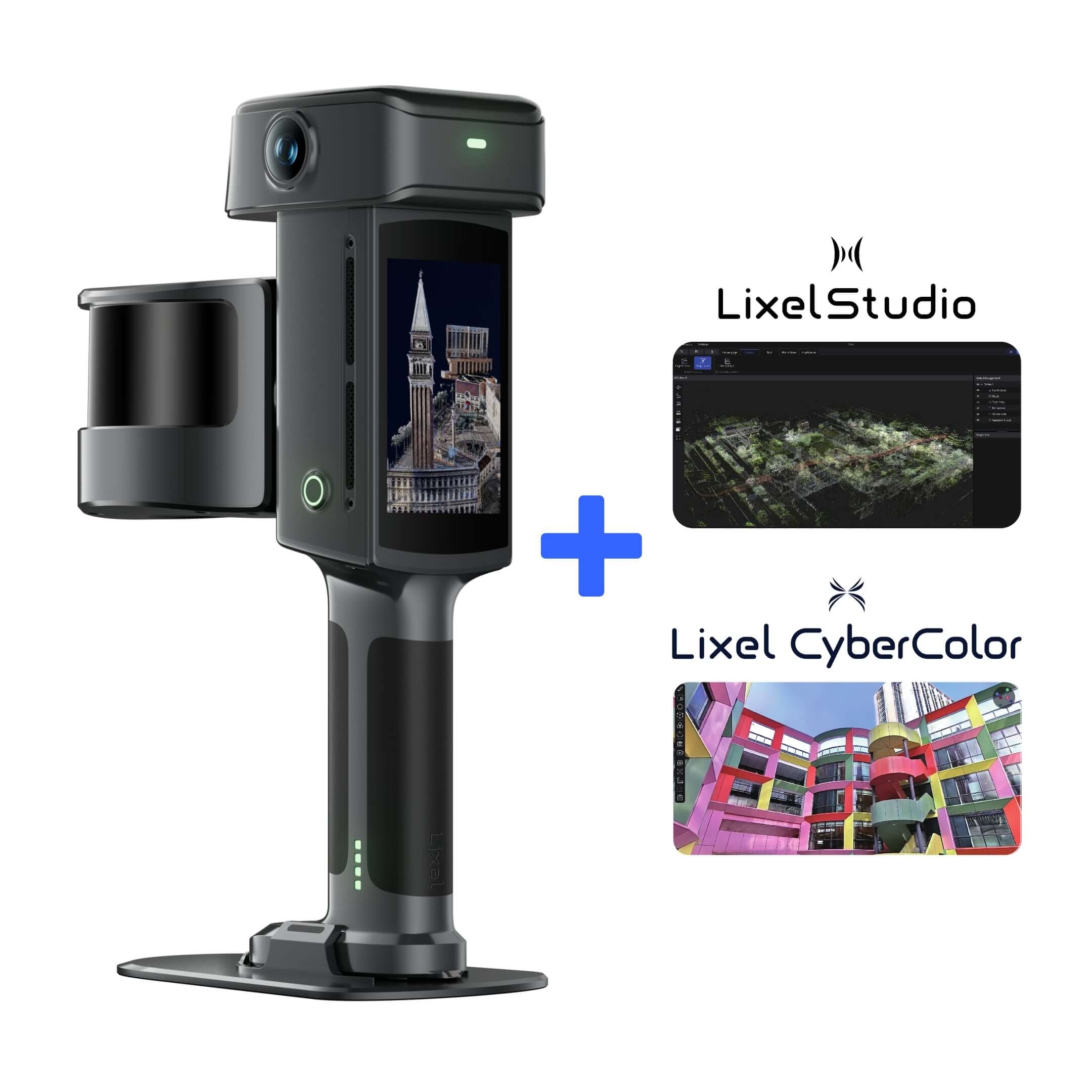
Lixel L3
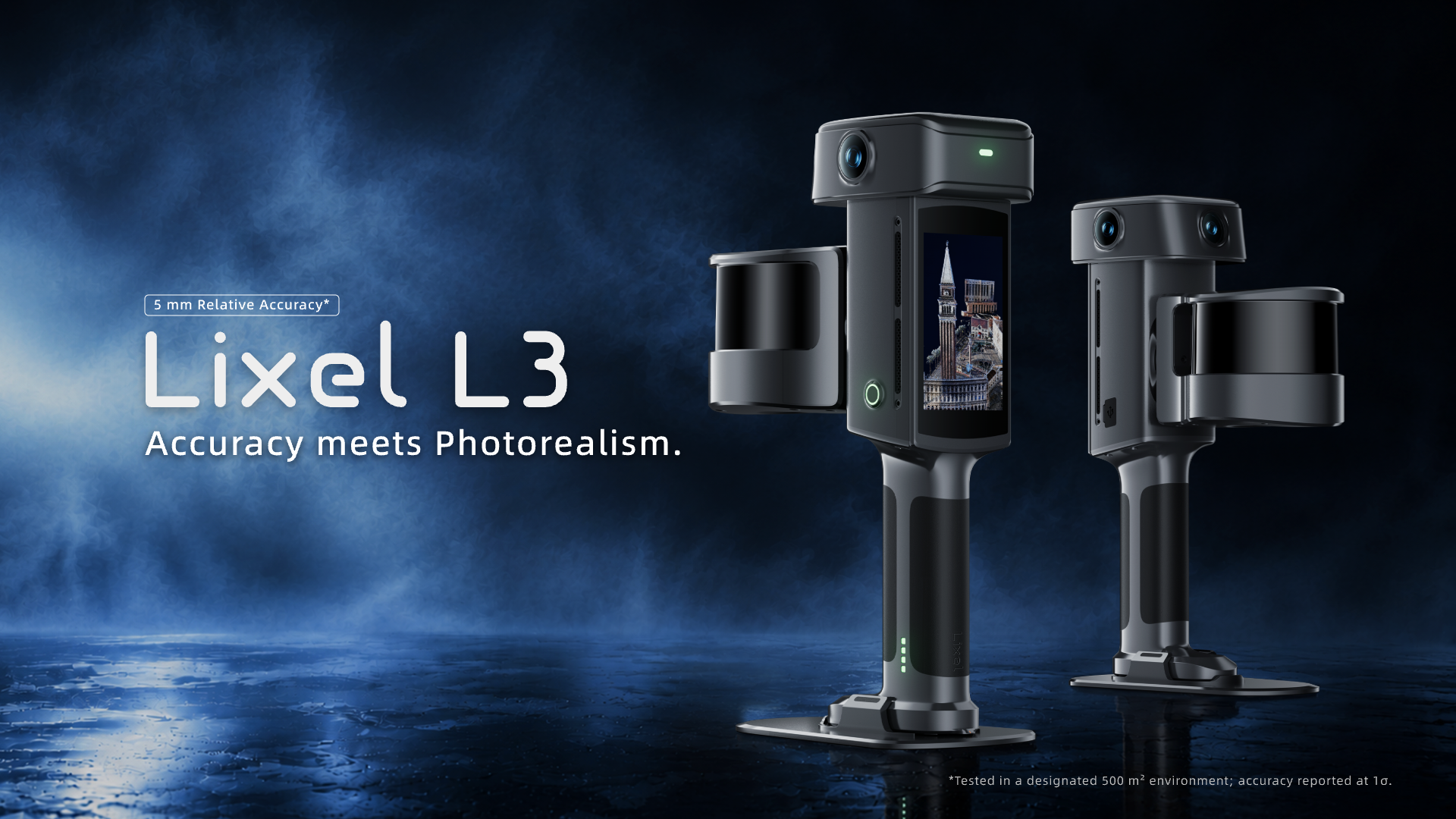
Accuracy meets photorealism.
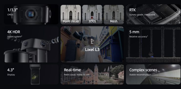
A handheld 3D scanner that records 5 mm relative accuracy and true color in the same pass. Walk through a space once and you come away with a point cloud, a textured mesh and a 3D Gaussian splatting model.
5 mmRelative accuracy
120 mMaximum range
640,000Points per second
4K HDRThree-camera system
Built for sites where accuracy and appearance both matter.
The Lixel L3 is the flagship handheld scanner in the XGRIDS range. LiDAR, three cameras, an IMU and a survey-grade RTK receiver are packed into a single body, and a built-in screen lets you check the scan before you leave the site.
Surveyors get geometry they can measure from. Designers, producers and clients get color and detail that look like the real place.
2.5 kgWeight with battery
100 minContinuous operation
1 TBInternal storage
IP54Dust and splash protection
One scan, two ways to look at it
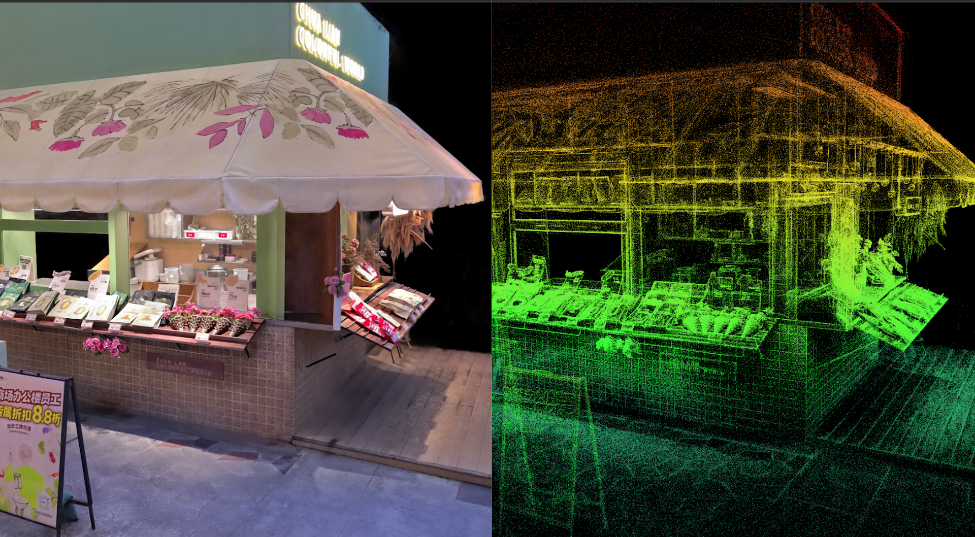
The L3 records geometry and color in the same pass, so one capture can be a photoreal model for presenting and a measurable point cloud for working.
True-color point cloud
Each point is colored from the camera images while you scan. Open it in the survey, BIM or CAD software you already use.
LAS, RCP, E57, PLY, iLAS
Textured mesh
A surface model with photo textures, suited to visualization, design review and web or GIS viewers.
OBJ, OSGB, 3D Tiles, USD
3D Gaussian splatting
A photorealistic scene generated from the camera images with Lixel CyberColor. Fine detail and lighting come through the way they do in a photograph.
LCC2, LCC, PLY
A new accuracy benchmark for handheld SLAM
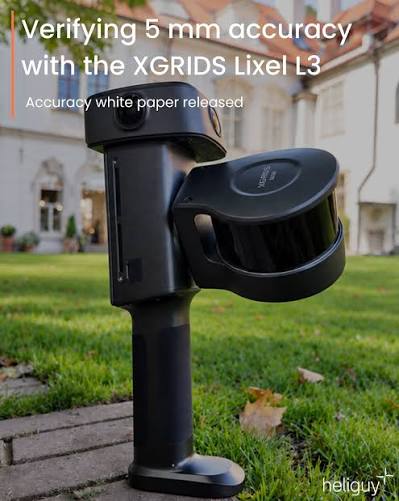
In a documented test, XGRIDS measured 5 mm post-processed relative accuracy against ground truth. SLAM, vision-assisted positioning and leveling optimization work together to keep drift low on longer scans.
5mm
Relative accuracy (1σ), post-processed. Point cloud thickness is 5 mm or better within 10 m of the walking path.
| Relative accuracy, post-processed (1σ) | 5 mm |
|---|---|
| Point cloud thickness | ≤ 5 mm |
| Absolute accuracy, horizontal and vertical (RMSE) | 2 cm |
| Repeatability | 2 cm |
| Real-time relative accuracy | 1 cm |
| Real-time absolute accuracy (RMSE) | 2.5 cm |
| Levelness with RTK fusion | 0.005° |
| Levelness without RTK fusion | 0.02° |
Figures are published by the manufacturer. The 5 mm result was measured in a dedicated 500 m² test environment. Absolute figures assume open sky with good satellite geometry. Results on site depend on the environment and the workflow.
Unboxing, first scan and on-device processing
Watch a Lixel L3 come out of the case, run its first scan and process the result on the scanner itself.
Video by AECT Solutions.
From sensors to deliverables
Four systems share one body and one clock, which is why geometry, color and position line up without extra steps.
01
Sense
An eye-safe Class 1 laser with a 360° × 270° field of view captures ceilings and overhead services as you walk. Three 50 MP cameras with 1/1.3-inch sensors hold detail in bright windows and dark corners. A built-in survey-grade RTK receiver tracks BeiDou, GPS, GLONASS, Galileo, QZSS, IRNSS and SBAS.
- LiDAR range0.7 to 120 m
- Cameras3 × 50 MP, DCG 4K HDR
- RTK horizontal0.8 cm + 1 ppm
02
Process
A 4.3-inch screen shows the live colored point cloud, your trajectory and coverage. The scanner runs on its own, so you do not need to pair a phone or tablet, and cleanup such as moving-object removal and loop closure happens while you walk.
- Display4.3 in, up to 1,000 nits
- Storage1 TB UFS
- PowerUnder 30 W
03
Deliver
Point clouds, textured meshes and 3D Gaussian splatting scenes in the formats your team already uses, ready for survey, BIM, GIS, visual effects and presentation work.
- Point cloudLAS, RCP, E57, PLY, iLAS
- MeshOBJ, OSGB, 3D Tiles, USD
- SplattingLCC2, LCC, PLY
The scanner, and the software that finishes the job
There is no tripod, no station setup and no target placement. A typical walkthrough covers around 100 m² in about ten minutes, then Lixel Studio and Lixel CyberColor take the data from there.
- ScanWalk the space at a normal pace while the L3 records LiDAR, images, motion and satellite data.
- ReviewCheck trajectory, coverage and a model preview on the built-in screen.
- ProcessProcess the data locally, then refine and align it in XGRIDS desktop software.
- ExportOutput point clouds, meshes and splatting scenes in the formats your team uses.
Processing that starts on the scanner
A lot of the cleanup happens while you walk, so problems show up when you can still fix them.
- Scan assistanceChecks quality during capture so a bad scan is found on site.
- Moving object removalFilters out people and vehicles passing through the scene.
- Noise filteringCleans and smooths the point cloud in real time.
- Loop closureCorrects drift across large areas and closed loops as you go.
- Low-feature mappingStays stable in plain corridors and tunnels where SLAM usually struggles.
- Map fusionJoins several scans or visits into one dataset without control points.
- PPK post-processingCorrects the trajectory afterwards if there was no live RTK link.
- On-model measurementMeasure and preview points of interest directly on the device.
- Privacy protectionBlurs faces and license plates when you scan occupied or public places.
- Stockpile volumeCalculates and compares volumes for quarries, landfills and earthworks.
Two LiDAR versions
The L3 comes with a 16-channel or a 32-channel LiDAR. Range, cameras and accuracy are the same on both. The difference is how many points are collected each second.
Lixel L3 16-channel
320,000pts/s
16 channels. Range, cameras and accuracy as specified.
Lixel L3 32-channel
640,000pts/s
32 channels. Twice the points per second for denser clouds.
Compared with the Lixel L2 Pro
| Lixel L3 | Lixel L2 Pro | |
|---|---|---|
| Relative accuracy | 5 mm | 1 cm |
| Absolute accuracy | 2 cm | 3 cm |
| Point cloud thickness | 5 mm | 5 mm |
| Levelness with RTK fusion | 0.005° | 0.015° |
| Levelness without RTK fusion | 0.02° | 0.03° |
| Cameras | 3 × 50 MP | 2 × 48 MP |
| Sensor size | 1/1.3-inch | 1/2-inch |
| Output resolution | 4096 × 3072 | 4000 × 3000 |
| HDR | 4K HDR | Not supported |
| Built-in display | 4.3-inch | Not included, use the Lixel Go app |
| Weight | 2.5 kg with battery | 1.7 kg without battery |
| LiDAR range | 120 m | 120 m, or 300 m on the 32/300 version |
Based on specifications published by XGRIDS. The L2 Pro remains the longer-range and lighter option.
Where it is used
- 01
Surveying and mapping
Georeferenced capture of buildings, streets and sites, with RTK built in.
- 02
Architecture, engineering and construction
As-built records and scan-to-BIM. RCP and E57 files open directly in common BIM tools.
- 03
Digital twins
Accurate geometry with realistic color for facilities, plants and infrastructure.
- 04
Film and virtual production
Sets and locations captured as splatting scenes or meshes, with USD export.
- 05
Mining and earthworks
Stockpile volume calculation and comparison between surveys.
- 06
Heritage and public safety
Fast, complete records of historic structures and incident scenes.
Technical specifications
LiDAR
| Laser class | Class 1, 905 nm (eye-safe) |
|---|---|
| Channels | 16 or 32 |
| Point rate | 320,000 pts/s (16-channel) or 640,000 pts/s (32-channel) |
| Range | 0.7 to 120 m |
| Field of view | 360° × 270° |
Accuracy
| Relative accuracy, post-processed (1σ) | 5 mm, in a dedicated 500 m² test environment |
|---|---|
| Point cloud thickness, post-processed | ≤ 5 mm within 10 m of the walking path |
| Absolute accuracy (RMSE) | 2 cm horizontal and vertical, open sky |
| Repeatability | 2 cm, open sky |
| Real-time relative accuracy | 1 cm, laboratory conditions |
| Real-time absolute accuracy (RMSE) | 2.5 cm, open sky, WGS 84 and CGCS2000 |
| Levelness | 0.005° with RTK fusion, 0.02° without |
Imaging
| Cameras | One forward-facing and two panoramic, 3 × 50 MP |
|---|---|
| Sensor | 1/1.3-inch CMOS |
| Output resolution | 4096 × 3072 per camera |
| HDR | DCG 4K HDR |
| Shutter | Rolling |
Positioning and RTK
| Constellations | BeiDou, GPS, GLONASS, Galileo, QZSS, IRNSS, SBAS |
|---|---|
| Horizontal accuracy | 0.8 cm + 1 ppm |
| Vertical accuracy | 1.5 cm + 1 ppm |
| Antenna | 360° right-hand circularly polarized, 4.0 dBi peak gain |
| Post-processing | PPK supported |
Hardware and power
| Dimensions | 206 × 107 × 329 mm |
|---|---|
| Weight | Approx. 2.5 kg including battery |
| Housing | Aluminum alloy |
| Display | 4.3-inch TFT, 480 × 800, up to 1,000 nits |
| Internal storage | 1 TB UFS |
| Data interface | USB 3.1 Gen2 |
| Wireless | Wi-Fi 802.11 a/b/g/n/ac/ax, Bluetooth |
| Battery | 14.4 V, 3350 mAh |
| Operating time | 100 minutes continuous |
| Power consumption | Under 30 W |
| Operating temperature | -20 °C to 50 °C |
| Ingress protection | IP54 |
Output formats
| Point cloud | .las, .rcp, .e57, .ply, .ilas |
|---|---|
| Imagery | .jpg |
| Mesh | .osgb, .obj |
| 3D Gaussian splatting | .lcc2, .lcc, .ply |
| Other | 3D Tiles (.3tz), .usd |
Frequently asked questions
How accurate is the Lixel L3?
The manufacturer specifies 5 mm post-processed relative accuracy (1σ), measured in a dedicated 500 m² test environment, and 2 cm absolute accuracy (RMSE) in open sky with the built-in RTK. On a real site the result depends on the environment, the scan path and the processing workflow.
Do I need an external RTK module?
No. The RTK receiver is built into the scanner. If you scanned without a live RTK link, PPK post-processing can correct the trajectory afterwards.
Do I need a phone or tablet to run a scan?
No. The L3 has a 4.3-inch screen and runs the scan independently. You can follow the live point cloud, trajectory and coverage on the scanner itself.
Which file formats can I export?
Point clouds as LAS, RCP, E57, PLY and iLAS. Meshes as OBJ and OSGB. Gaussian splatting scenes as LCC2, LCC and PLY. Images as JPG, plus 3D Tiles (.3tz) and USD for web, GIS and visual effects work.
What is the difference between the 16-channel and 32-channel versions?
Only the LiDAR head. The 16-channel version collects 320,000 points per second and the 32-channel version collects 640,000. Range, cameras and accuracy are the same.
How long does the battery last?
About 100 minutes of continuous operation on one charge. The scanner has 1 TB of internal storage, which is enough for multi-day projects.
Can I use it outdoors and in bad weather?
The L3 works from -20 °C to 50 °C and is rated IP54 against dust and splashes. It is not meant for use in rain, so plan outdoor sessions around the weather.